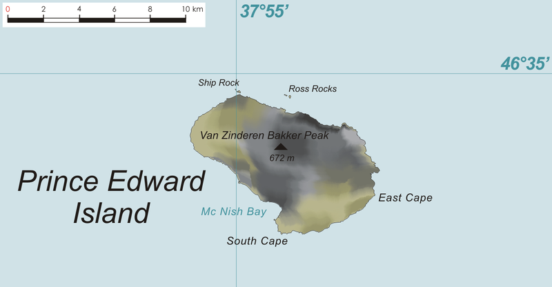
File:PrEdwIsland Map.png

本预览的尺寸:800 × 416像素。 其他分辨率:320 × 167像素 | 640 × 333像素 | 1,274 × 663像素。
原始文件 (1,274 × 663像素,文件大小:149 KB,MIME类型:image/png)
文件历史
点击某个日期/时间查看对应时刻的文件。
| 日期/时间 | 缩略图 | 大小 | 用户 | 备注 | |
|---|---|---|---|---|---|
| 当前 | 2009年6月22日 (一) 11:52 |  | 1,274 × 663(149 KB) | Telim tor | == {{int:filedesc}} == {{Information |Description= {{de|Karte der Prinz-Edward-Insel, Prinz-Edward-Inseln, im südlichen Indischen Ozean}} {{en|Map of Prince Edward Island, Prince Edward Islands, in the Southern Indian Ocean}} |Source={{own}}, based on or |
文件用途
以下页面使用本文件:
全域文件用途
以下其他wiki使用此文件:
- af.wiki.x.io上的用途
- de.wiki.x.io上的用途
- nl.wiki.x.io上的用途

