File:Moreux - PIA00420 (cropped).jpg

Moreux_-_PIA00420_(cropped).jpg (518 × 519像素,文件大小:34 KB,MIME类型:image/jpeg


摘要

描述
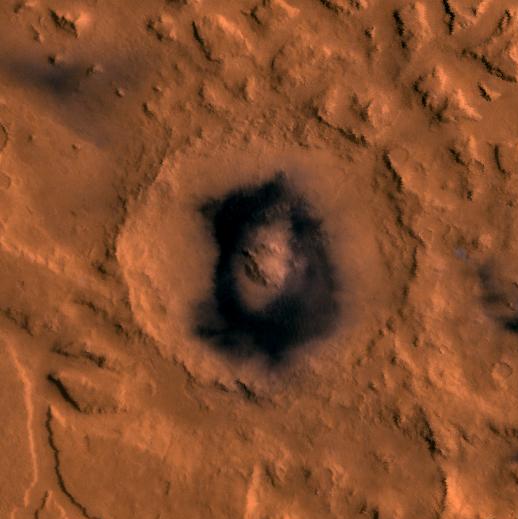
English: Color image of part of the Ismenius Lacus region of Mars (MC-5 quadrangle) containing the impact crater Moreux (right center); north toward top. The scene shows heavily cratered highlands in the south on relatively smooth lowland plains in the north separated by a belt of dissected terrain, containing flat-floored valleys, mesas, and buttes. This image is a composite of Viking medium-resolution images in black and white and low-resolution images in color. The image extends from latitude 36 degrees N. to 50 degrees N. and from longitude 310 degrees to 340 degrees; Lambert conformal conic projection. The dissected terrain along the highlands/lowlands boundary consists of the flat-floored valleys of Deuteronilus Mensae (on left) and Prontonilus Mensae (on right) and farther north the small, rounded hills of knobby terrain. Flows on the mensae floors contain striae that run parallel to valley walls; where valleys meet, the striae merge, similar to medial moraines on glaciers. Terraces within the valley hills have been interpreted as either layered rocks or wave terraces. The knobby terrain has been interpreted as remnants of the old, densely cratered highland terrain perhaps eroded by mass wasting.
日期
来源 http://photojournal.jpl.nasa.gov/catalog/PIA00420
作者 NASA/JPL/USGS
其他版本
图片提取流程
本文件提取自另一个文件
:​PIA00420.jpg
原始文件

许可协议

Public domain 本文件完全由NASA创作,在美国属于公有领域。根据NASA的版权方针,NASA的材料除非另有声明否则不受版权保护。(参见Template:PD-USGov/zhNASA版权方针页面JPL图片使用方针。)
警告:

说明

添加一行文字以描述该文件所表现的内容

此文件中描述的项目

描繪內容

文件历史

点击某个日期/时间查看对应时刻的文件。

日期/时间缩⁠略⁠图大小用户备注
当前2018年2月25日 (日) 16:492018年2月25日 (日) 16:49版本的缩略图518 × 519(34 KB)AsqueladdFile:PIA00420.jpg cropped 84 % horizontally and 73 % vertically using CropTool with lossless mode.

以下页面使用本文件:

全域文件用途

以下其他wiki使用此文件: