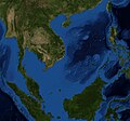
File:Mar de China Meridional - BM WMS 2004.jpg

本预览的尺寸:643 × 600像素。 其他分辨率:257 × 240像素 | 514 × 480像素 | 823 × 768像素 | 1,060 × 989像素。
原始文件 (1,060 × 989像素,文件大小:251 KB,MIME类型:image/jpeg)
文件历史
点击某个日期/时间查看对应时刻的文件。
| 日期/时间 | 缩略图 | 大小 | 用户 | 备注 | |
|---|---|---|---|---|---|
| 当前 | 2010年6月22日 (二) 11:58 |  | 1,060 × 989(251 KB) | Serg!o | {{Information |Description={{es|Foto satelital del Mar de China Meridional}} {{en|Satellite Picture of the South China Sea}} |Source=Satellite pictures, from NASA World Wind Globe, version 1.4 |Date=22 |
文件用途
以下页面使用本文件:
全域文件用途
以下其他wiki使用此文件:
- ace.wiki.x.io上的用途
- af.wiki.x.io上的用途
- ar.wiki.x.io上的用途
- ast.wiki.x.io上的用途
- as.wiki.x.io上的用途
- azb.wiki.x.io上的用途
- az.wiki.x.io上的用途
- ban.wiki.x.io上的用途
- ba.wiki.x.io上的用途
- bcl.wiki.x.io上的用途
- bg.wiki.x.io上的用途
- bn.wiki.x.io上的用途
- ca.wiki.x.io上的用途
- cv.wiki.x.io上的用途
- cy.wiki.x.io上的用途
- dtp.wiki.x.io上的用途
- el.wiki.x.io上的用途
- en.wiki.x.io上的用途
- eo.wiki.x.io上的用途
- et.wiki.x.io上的用途
- fa.wiki.x.io上的用途
- fr.wikinews.org上的用途
- gl.wiki.x.io上的用途
- gn.wiki.x.io上的用途
- hif.wiki.x.io上的用途
- hu.wiki.x.io上的用途
- hy.wiki.x.io上的用途
- iba.wiki.x.io上的用途
- id.wiki.x.io上的用途
- incubator.wikimedia.org上的用途
- kcg.wiki.x.io上的用途
- kk.wiki.x.io上的用途
- km.wiki.x.io上的用途
- ko.wiki.x.io上的用途
- lo.wiki.x.io上的用途
- lt.wiki.x.io上的用途
- ms.wiki.x.io上的用途
- my.wiki.x.io上的用途
- mzn.wiki.x.io上的用途
- ne.wiki.x.io上的用途
- nn.wiki.x.io上的用途
- no.wiki.x.io上的用途
- os.wiki.x.io上的用途
- pl.wiki.x.io上的用途
查看此文件的更多全域用途。

