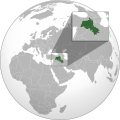
File:Kurdish-inhabited areas (orthographic projection with inset).svg

此SVG文件的PNG预览的大小:512 × 512像素。 其他分辨率:240 × 240像素 | 480 × 480像素 | 768 × 768像素 | 1,024 × 1,024像素 | 2,048 × 2,048像素。
原始文件 (SVG文件,尺寸为512 × 512像素,文件大小:852 KB)
文件历史
点击某个日期/时间查看对应时刻的文件。
| 日期/时间 | 缩略图 | 大小 | 用户 | 备注 | |
|---|---|---|---|---|---|
| 当前 | 2023年11月11日 (六) 03:25 |  | 512 × 512(852 KB) | Treetoes023 | Making border overlap easier to see. |
| 2023年9月28日 (四) 17:24 |  | 512 × 512(852 KB) | Golden | restoring previous edit but with the shading | |
| 2023年9月28日 (四) 02:15 |  | 512 × 512(794 KB) | Treetoes023 | Reverted to version as of 19:21, 13 June 2023 (UTC): Restoring shading. | |
| 2023年9月1日 (五) 20:09 |  | 512 × 512(885 KB) | Golden | rmv de facto countries with zero recognition (Somaliland, NKR) | |
| 2023年6月13日 (二) 19:21 |  | 512 × 512(794 KB) | Isochrone | oops | |
| 2023年6月13日 (二) 19:17 |  | 512 × 512(793 KB) | Isochrone | change per request | |
| 2023年6月5日 (一) 16:45 |  | 512 × 512(836 KB) | Isochrone | Uploaded a work by {{u|Isochrone}} from {{own using}} * 1992 CIA map with UploadWizard |
文件用途
以下页面使用本文件:
全域文件用途
以下其他wiki使用此文件:
- ar.wiki.x.io上的用途
- ckb.wiki.x.io上的用途
- en.wiki.x.io上的用途
- got.wiki.x.io上的用途
- incubator.wikimedia.org上的用途
- ka.wiki.x.io上的用途
- lt.wiki.x.io上的用途
- mr.wiki.x.io上的用途
- ne.wiki.x.io上的用途
- pl.wiki.x.io上的用途
- qu.wiki.x.io上的用途
- ru.wiki.x.io上的用途
- simple.wiki.x.io上的用途
- te.wiki.x.io上的用途

