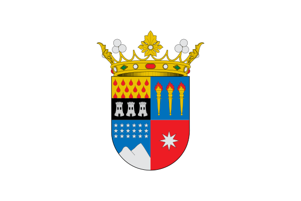
File:Flag of Ñuble Region, Chile.svg

此SVG文件的PNG预览的大小:600 × 400像素。 其他分辨率:320 × 213像素 | 640 × 427像素 | 1,024 × 683像素 | 1,280 × 853像素 | 2,560 × 1,707像素。
原始文件 (SVG文件,尺寸为600 × 400像素,文件大小:150 KB)
文件历史
点击某个日期/时间查看对应时刻的文件。
| 日期/时间 | 缩略图 | 大小 | 用户 | 备注 | |
|---|---|---|---|---|---|
| 当前 | 2018年9月8日 (六) 00:12 |  | 600 × 400(150 KB) | Janitoalevic | . |
| 2018年9月5日 (三) 23:19 |  | 600 × 400(150 KB) | Janitoalevic | Bandera oficial | |
| 2017年7月17日 (一) 20:46 |  | 600 × 400(11 KB) | Janitoalevic | . | |
| 2017年7月16日 (日) 19:27 |  | 600 × 400(11 KB) | Janitoalevic | . | |
| 2017年7月16日 (日) 19:26 |  | 600 × 400(11 KB) | Janitoalevic | User created page with UploadWizard |
文件用途
以下21个页面使用本文件:
全域文件用途
以下其他wiki使用此文件:
- cs.wiki.x.io上的用途
- de.wiki.x.io上的用途
- Wikipedia:Vorlagen subnationaler Einheiten mit Flagge
- Flaggen und Wappen der Regionen Chiles
- Región de Ñuble
- Vorlage:Info ISO-3166-2:CL-NB
- Vorlage:CL-NB
- Vorlage Diskussion:Flagge/Test
- Liste der Flüsse in Chile
- Provinz Itata
- Provinz Diguillín
- Provinz Punilla
- Vorlage:Navigationsleiste Provinzen XVI Region (Chile)
- en.wiki.x.io上的用途
- Flag of Chile
- Regions of Chile
- List of Chilean flags
- Google Street View in South America
- Google Street View in Chile
- User:Werdoland/sandbox
- Ñuble Region
- User:Extended Cut/sandbox
- 2020 Chilean constitutional referendum
- COVID-19 pandemic in Chile
- Template:Country data Ñuble Region
- Template:COVID-19 pandemic data/Chile medical cases
- Template:COVID-19 pandemic data/Chile medical cases by commune
- User:SuperSkaterDude45
- 2021 Chilean municipal elections
- 2021 Chilean gubernatorial elections
- Statistics of the COVID-19 pandemic in Chile
- 2022–2023 mpox outbreak in Chile
- List of country subdivision flags in South America
- eo.wiki.x.io上的用途
- es.wiki.x.io上的用途
查看此文件的更多全域用途。

