File:1st-SOUSE-sensors.png
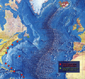
1st-SOUSE-sensors.png (300 × 280像素,文件大小:155 KB,MIME类型:image/png)
文件历史
点击某个日期/时间查看对应时刻的文件。
| 日期/时间 | 缩略图 | 大小 | 用户 | 备注 | |
|---|---|---|---|---|---|
| 当前 | 2008年8月5日 (二) 00:51 |  | 300 × 280(155 KB) | Matrek | {{Information |Description={{en|1=The first SOSUS stations – NAVFACs – were sited from Barbados to Nova Scotia on a huge semi-circle that opened onto the deepwater abyss west of the Mid-Atlantic Ridge. Later, additional Atlantic-area stations were est |
文件用途
以下2个页面使用本文件:
全域文件用途
以下其他wiki使用此文件:
- en.wiki.x.io上的用途
- es.wiki.x.io上的用途
- et.wiki.x.io上的用途
- fr.wiki.x.io上的用途
- id.wiki.x.io上的用途
- it.wiki.x.io上的用途
- ko.wiki.x.io上的用途
- pl.wiki.x.io上的用途
- sv.wiki.x.io上的用途
- vi.wiki.x.io上的用途


