艾塔斯卡湖
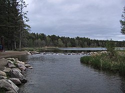
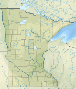
艾塔斯卡湖(英語:Lake Itasca,奧吉布瓦語:Omashkoozo-zaaga'igan;/aɪˈtæskə/,eye-TASS-kə)[1]是一个小型冰蚀湖,其占地面积约为1.8平方英里(4.7平方公里;1,200英畝)。该湖泊位于美国明尼苏达州清水县西南部的艾塔斯卡州立公园内,因其为密西西比河的源头而得名。该湖泊的平均深度为20至35英尺(6.1至10.7米),海拔高度约为1,475英尺(450米)。
| 艾塔斯卡湖 Lake Itasca(英語) Omashkoozo-zaaga'igan(奧吉布瓦語) | |
|---|---|
 艾塔斯卡湖是密西西比河的源头 | |
| 位置 | 艾塔斯卡州立公园 |
| 坐标 | 47°13′05″N 95°12′26″W / 47.21806°N 95.20722°W |
| 类型 | 冰蚀湖 |
| 主要流入 | 尼科利特溪和埃尔克湖河口 |
| 主要流出 | 密西西比河 |
| 所在国家 | |
| 表面积 | 1.8 sq mi(4.7 km2) |
| 平均深度 | 20—35英尺(6—11米) |
| 表面海拔 | 1,475英尺(450米) |
| 岛屿 | 斯库尔克拉夫特岛 |
艾塔斯卡湖在奥吉布瓦语中为“Omashkoozo-zaaga'igan”,意为“糜鹿湖”。[2]而后来亨利·斯库尔克拉夫特将其更名为“Itasca”,该词来源于两个拉丁文单词“veritas”和“caput”的组合,意为“(密西西比河)真正的源头”。[3][4]
密西西比河源头
编辑注释
编辑参考文献
编辑- ^ Minnesota Pronunciation Guide. Associated Press. [2011-07-04]. (原始内容存档于2011-07-22).
- ^ Winchell, N. H. The Geological and Natural History Survey of Minnesota. The fifteenth annual report for the year 1886.. Minnesota Geological Survey. 1887 [2023-05-10]. (原始内容存档于2021-12-27) (英语).
- ^ Bright, William. Native American Placenames of the United States. University of Oklahoma Press. : 188 [2023-05-10]. ISBN 978-0-8061-3598-4 (英语).
- ^ Upham, Warren. Itasca County. Minnesota Place Names: A Geographical Encyclopedia. Minnesota Historical Society. [2007-08-14]. (原始内容存档于2011-01-08).
- ^ 5.0 5.1 Kammerer, J.C. Largest Rivers in the United States. United States Geological Survey. May 1990 [2023-05-10]. (原始内容存档于2020-05-13).
- ^ Nell, Donald F.; Demetriades, Anthony. The True Utmost Reaches of the Missouri: Were Lewis and Clark Wrong When They Identified the Source of This Great River?. Montana Outdoors. July–August 2005 [2023-05-10]. (原始内容存档于2012-01-18).

